15 Basic parameters in urban design
Parametric Urbanism
This list is not comprehensive but a starting point for any planning project.
In a successfully designed urban plan the designer needs to manage and manipulate multiple interconnected parameters. Each parameter can be investigated and developed independently, but will also have to be tested in relation to other related parameters. This can be done using analogue or digital methods or both.
The complexity of these relations does make digital methods preferable as designers can then introduce optimization through the use of algorithms. However, there is also a need to introduce some chaos/unexpected elements into the system, which does not lend itself easily to simple digital coding.
Cities are complex systems and this list or urban parameters is not comprehensive but will give an idea of the basic variables for a systemic approach to urban design.
1. Facilitate spaces for living, working, shopping and recreation
In urban theory spaces are categorized according to the three basic functions or urban life: Home = 1st space, Work = 2nd Space, and recreation/spaces not work or home = 3rd space. The fundamental purpose of urban design is to provide these for the urban population. If design methods or policies ignore this primary directive, they fail fundamentally.
The current housing crisis in many major western cities demonstrate the failure of their planning policies and urban designers. While development of slums in developing countries is another example of this failure, for different reasons, but both are due to broken systems.
Emergence of favelas is a successful development where local population steps in to manage the failure of urban planning. Favelas are an example of how urban environment is capable of self-organizing large and complex urban plans.
To the other extreme, facilitating user spaces also means not to construct, or reduce urban development when needed. As an example, the construction of “ghost cities” in places like China and Turkey is a failure to manage this basic parameter, while the de-industrialization of Detroit is a challenge of urban reduction which seems to be working.
On the micro level, working at home will become an increasing demand in the future, with not just pressure on internal space allocation and planning, but also the 24 hour functionality of neighbourhoods. All affecting the macro level directly.
2. Travel times
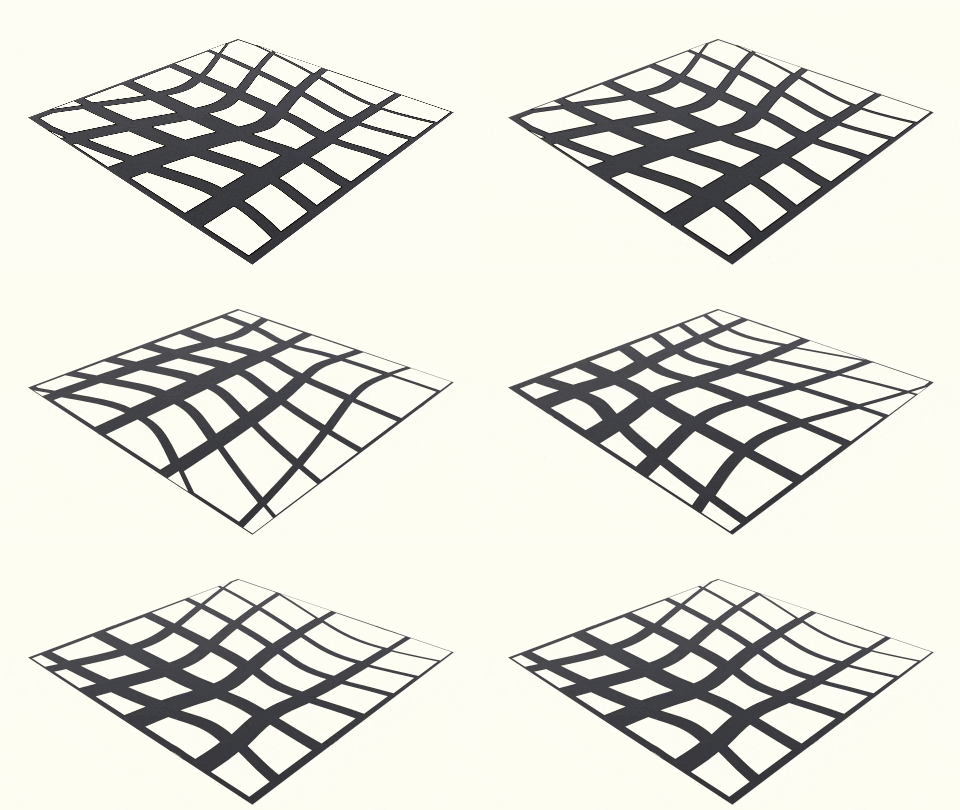 Transport is not about speed, it’s about time, mass and cost. How to move the greatest number of people in the least amount of time with the least effort. This is one of the easiest parameters to lose sight of in the bigger picture: “It takes me too long to drive to work due to traffic, so we need more roads and overpasses”.
An example of not seeing the trees for the forest, this was the go-to urban problem solving up to the start of the century. In reality more roads cause more traffic jams through something called ‘Induced Demand”.
The simplest solution is to reduce distances and, in that way, reduce travel time. Increasing the density of the built environment shortens the average distances. This however will bounce up against the quality of the urban environment; external spaces, daylight and so on (see 3 below).
Any quality of life measurement will look at the type of transportation system and how people use it. The use of the system is a great indicator of the ease of use and health of the urban environment. This is measured through the transport type, from the best to the worst transport types:
- Walk
- Bicycle
- Mass transit
- Semi-mass transit
- Private automobile
Dense, functional and people friendly cities are cheaper per resident, more resilient and flexible than sprawling suburban cities.
3. Density
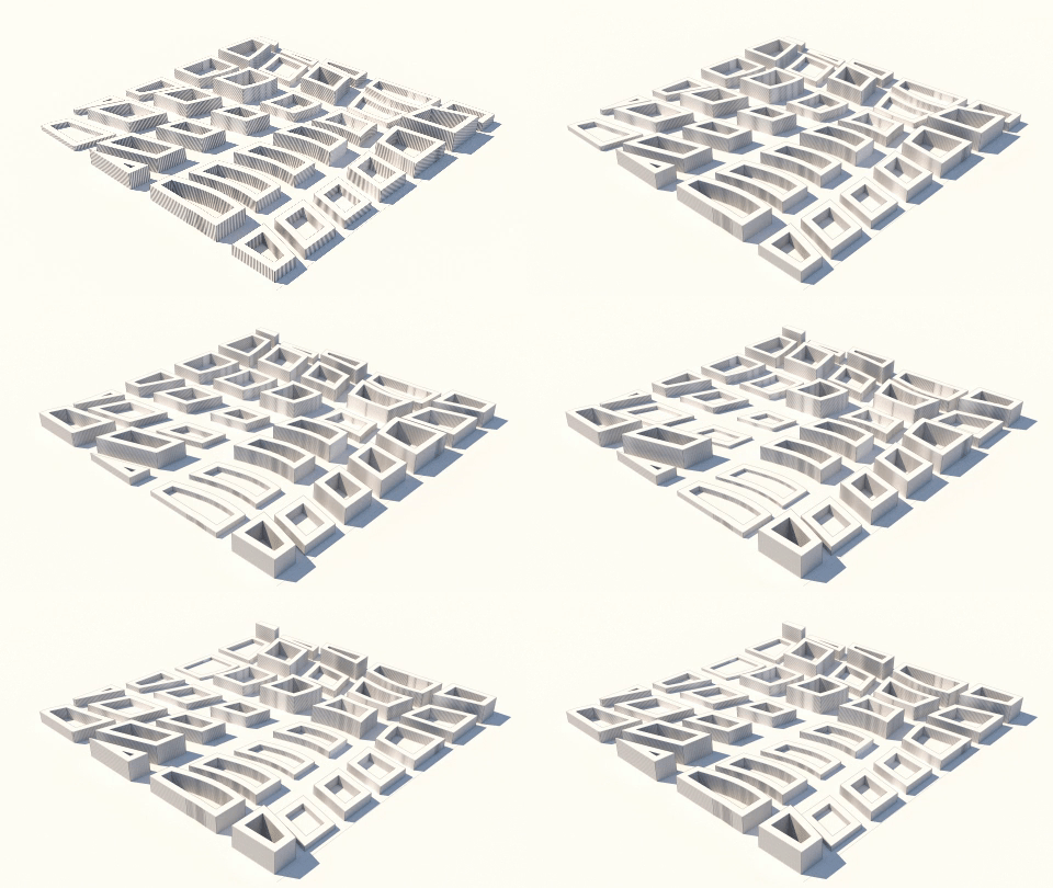
An important variable in many of the other parameters, density breaks down into the areas/volume of space each resident is allocated for living, working and 3rd space. Density needs to be measured against other parameters to introduce quality into the proposal. When this is not done, the result can start resembling the form of Kowloon Walled City. If you are going for a Blade Runner-esque urban environment this might be an option.
4. Daylight & Sunlight
Daylight is necessary for everyday activities internally and externally. It affects people’s psychology and is a major factor in determining the quality of a space. This is a very contextual parameter with locations closer to the poles having different needs than locations closer to the equator.
Natural light is different from direct sunlight, which is even more of a contextual factor 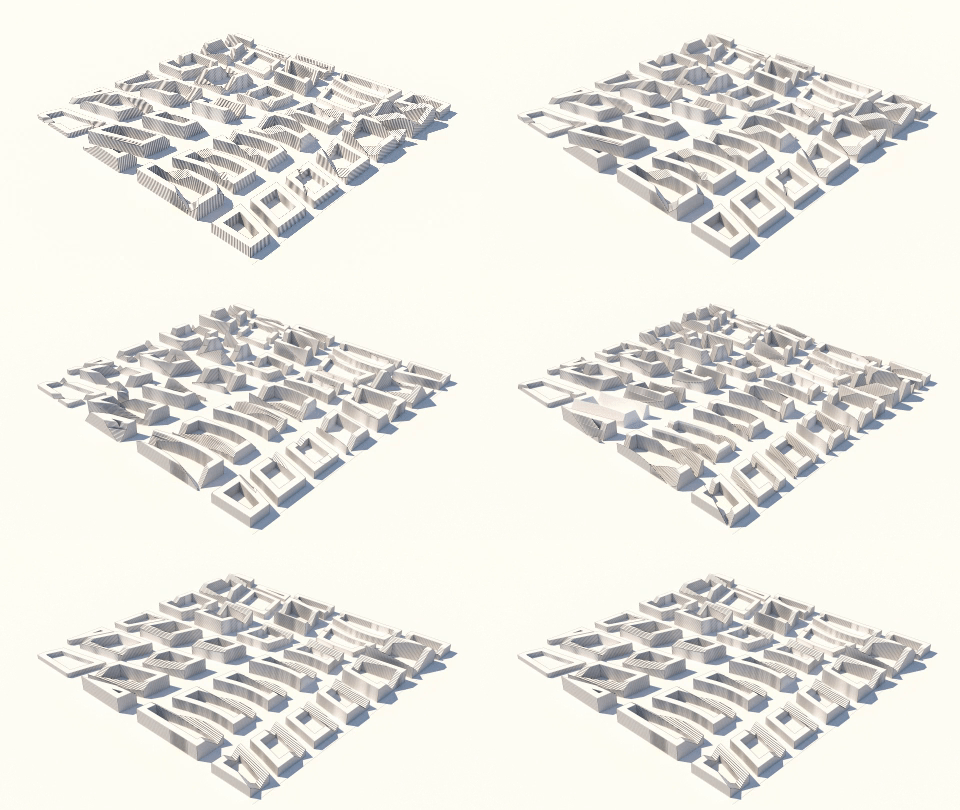 than daylight. Warm places closer to the equator need shade from the sun, especially in the summer. Cold places closer to the poles need the direct sun to make external and internal spaces more pleasant.
The Sun is a great tool to passively reduce energy consumption. Passive solar gain during cold months and the ability to place solar panels are all positive solutions. In the warmer months, solar gain needs to be reduced through passive design. The ability for architects to design with daylight and sunlight starts with the design of the urban environment.
5. Wind
The wind is one of the most complex parameters to model in the digital environment. Much like the
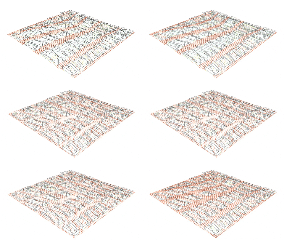 sun, wind parameter depends on the location of the site. Cold locations need shelter from the wind, while prominent local winds can passively cool down hot urban environments. The original western grid design by Hippodamus of Miletus was used to bring the morning and evening sea-breeze into the Greek coastal cities to cool them down.
Wind is 3 dimensional and has a complex relationship with high-rise development. Massing forms will affect structural wind-loads, localized ground wind nuisance, and the ability to use balconies amongst many other factors.
This does offer the opportunity for wind power generation. However, there are very few successful architectural examples of this in an urban environment.
6. View
Views are not just long views over open landscape and public spaces. These also include the visual engagement with the street and local neighbors. They can also be either towards an important focal point or a wide aspect. Here it is important to keep in mind that if the various scales are not considered, the designer might create an economical hierarchy based on better views.
Outlook is a counter parameter to density, but this can be alleviated by clever massing and formal approaches to the urban fabric. It can also be countered with good architectural design. People mind less about short views if they are presented with something pleasant to look at. Both Barcelona and Paris are dense urban grids, but complain less about the lack of view than the Brits. View-lines and visual aspects can operate as parameters.
7. Transport system
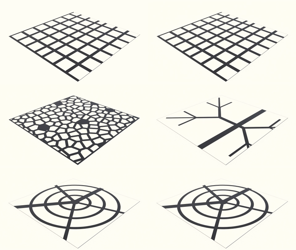 The Romans liked straight roads, Greeks invented the grid and the Germans invented street hierarchy. This idea lead to the Arterial (tree) structure of modern highway systems. A system that is very easy to control and calculate traffic congestion. This level of control makes it authoritarian as it forces the users to travel specific roads. It also creates larger traffic jams at major junctions requiring space hungry stacked interchange junctions.
A grid system is in it’s essence democratic, putting the responsibility of way-finding in the hands of users rather than traffic engineers. The negative side of that is the lack of pre-determination of which roads to make wider or narrower. Solution to this traditionally is either to make all roads uniform or some wider boulevards. With computational methods we are now able to experimenting using techniques like “space syntax” or other traffic analysis tools to predict road use in a complex and site-specific system.
Traffic networks depended originally primarily on landscape, public health and ownership boundaries. The first towns and cities like Çatalhöyük had little or no transport networks, while later towns evolved into complex narrow paths and few wide, public avenues.
8. Site context
Although the site location is a part of many other parameters, we also need to take into account the landscape of the site itself. Is it flat or hilly, on a mountainside of by a beach or river? Any parametric modelling will have to take this into account.
In The City of Tomorrow and Its Planning, Le Corbusier describes historical urban designers as the way a pack-donkey traverses a hill:
“The pack-donkey meanders along, meditates a little in his scatter-brained and distracted fashion; he zigzags in order to avoid the larger stones, or to ease the climb, or to gain a little shade; he takes the line of least resistance.”
In Le Corbusier’s mind, modern humans should clear, blast and build a straight road up that hill. Growing up in the “straight walker” paradise designed after Le Corbusier’s theories, many of us think the pack-donkey might be less scatter-brained than Le Corbusier.
The systemic designer creates coded models that look for an equilibrium between different parameters/variables.
9. Functional arrangements
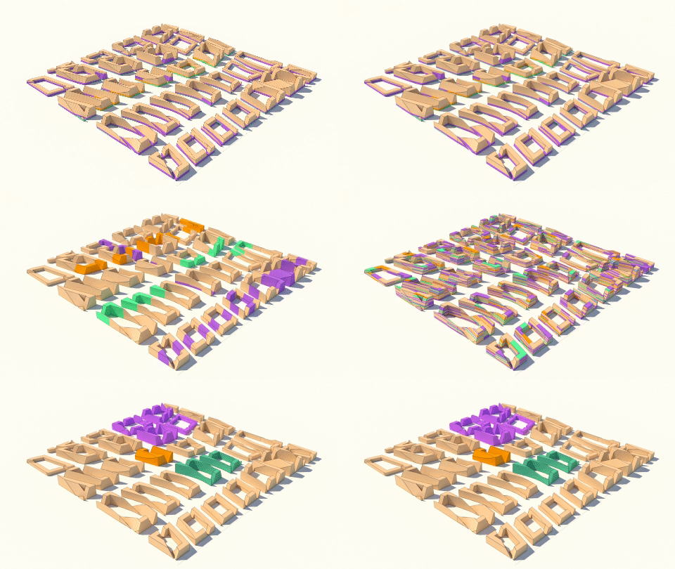 The location of specific activities arose relatively quickly in the evolution of cities. Dangerous, smelly and un-hygienic work found locations on the edge or downwind of towns. Holy activities and civic functions would be found a location that suited their purpose. All with the quality of life for the residents in mind.
This was later taken to the dystopic extreme by Ebenezer Howard and the Garden city movement which culminated in the theory of Zoning. Zoning would separate all the functions into their own zones, with the idea that the “home” would therefore become cleaner and more pleasant. This forced the residents to travel long distances between all 3 urban space functions and managed to increase the creation suburbs, car ownership and wasted travel times.
Historically cities to large extend “self-organised” their functional arrangement. Such self-organisations can now be planned through coding methods, both analogue and/or digital. Like e.g. by stipulating 1st two floors as work spaces, and upper floors as dwellings. Or in the most extreme examples follow the libertarian concepts of Rem Koolhas as derived from “Delirious New York”. With a grid established, and complete freedom to build within each block.
The parametric method can strategically include any of these, but offers a powerful tool in predicting the best arrangement through computation.
10. Public space
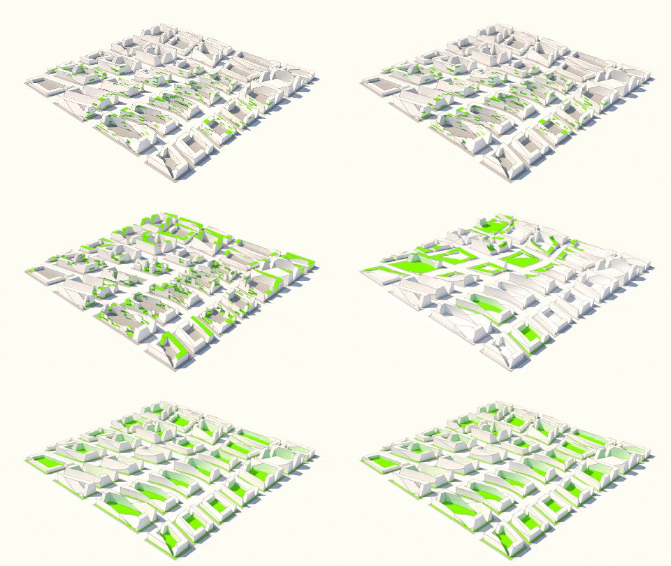 External space are on a spectrum from private (gardens) through semi-private (courtyard/apartment block garden) to public gardens and squares. Like functional arrangements, public space can be strategically arranged, and there should be some urban space within walkable distance from residents and workers. A road is usually not considered public “recreational” space. In Europe there is “18.2m2 of publicly accessible green space per inhabitant and 44% of the urban population lives within 300m of a public park”. A simple rule is that walking distance is 80 meters in 1 minute. This means that a public space that is a 10 minute walk from users, is 800 meters away.
The scale and location of public spaces should vary to accommodate variety of activities. Sports, picnics, reading and people watching all operate in different ways at different scales.
Climate is a vital parameter in designing public space. Colder climates call for smaller sheltered spaces, while moderate climates can enjoy larger spaces. Hot climates should consider solar shading. It makes little sense providing large open paved plazas with the sun beating down on it and turning the plaza into a large frying pan.
Large plazas are very attractive to autocrats who dream of making speeches to large devote audiences, while they are also a good location for protest and civil unrest. Their design needs to be well considered.
11. Landscape and nature
Many of these spatial climate problems can be elevated by landscape planting. Trees provide shade and plants reduce flooding, pollution and improve psychological health. Green-washing is a negative term for proposing trees as a way of proving our environmental credentials in architecture and urban design. This can be true to some extent, but it also proves how good plants are at making the urban environment more pleasant.
Landscape should not just be thought of as decoration or raft solution. (I.e. as patches of green rafts in an ocean of grey). Planting should be designed as an environmental system, able to include flora, fauna, and other forms of life. This should be a system that is connected internally and especially externally to allow for migrations. A city is not a machine, a city is a living entity indivisible from the world.
12. Food production
Directly connected to Landscape, inner city food production will become an increasingly common urban function in the future. Some of this might be traditional or semi-traditional agriculture supported by technology, or a pure indoor electric generated hydroponic mass production. This will require a different approach to urban design both on the local and regional scales.
Do facades carry elements of food growth? Is public landscape also food producing? Can shaded/dark building masses be utilised for hydroponic food production?
13. Specific activities
The “rock in the pond” concept is when a seemingly foreign object is dropped into a parametric system and the system has to respond to the object. This includes singular activities such as sports venues, public-, religious- and other functions that form an important focal nodes in the urban system. These are too many to mention, but each one will influence the urban system in major and minor ways.
14. Materials
Parametric design by definition cannot fall under the concept of internationalism. Many self-styled parametric architects are in reality still stuck in the internationalism of the modernist movement. Their designs may formally look seamlessly connected to the urban context, or have that “computational look”, but on the whole still use materials produced and transported in the global marketplace.
Local materials are both more sustainable and can ground the new development into the local context. The scale and variety of material choices needs to be kept considered. A uniform sublime material choice is rarely successful on large scale urban proposals.
15. Culture
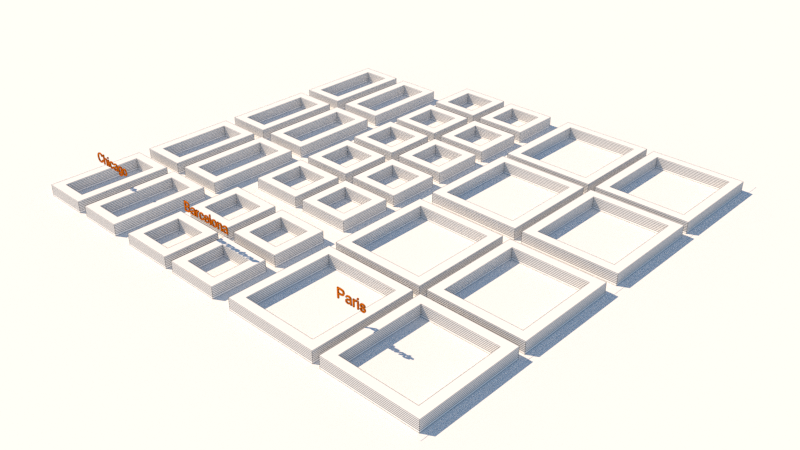 Both controversial and not the most difficult parameter in the design of the urban system. Culture in architecture and urbanism is steeped in bad nationalism, exceptionalism, NIMBYism, the tasteless and pastiche. However, cultures are systematically structured differently, from family structures to national institutions. For a successful urban plan, this needs to be addressed and expressed. Contextual history and artistic “languages” are elements that can be integrated into a successful cultural parameter.
This is not just a “soft” design variable, but impacts the “hard” functionality of the urban plan. For example, a city of democratically minded culture full of independent individual households requires a different dwelling size approach than an autocratically minded culture of tight knit large family units.
Our 15 variables are not exhaustive, they are simply the basic urban parameters that parametric designers should consider in any urban design proposal.
By Gudjon Thor Erlendsson
© 2020 Gudjon Thor Erlendsson, all rights reserved.
